
Dry Creek is one of the known collecting sites in Lake County, about 24 miles southwest of Lakeview. The name 'Dry Creek' comes from the USGS 'Dry Creek Bench' map. Because the area's streambeds often run dry for much of the year, the name fits perfectly.
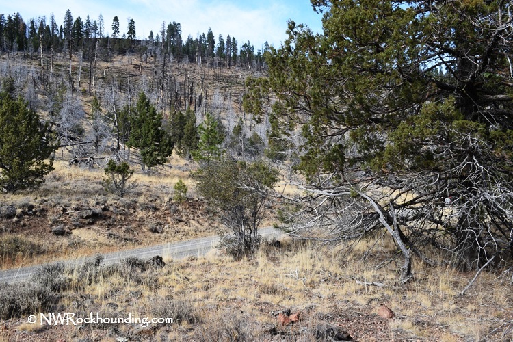
The Dry Creek area lies in the volcanic uplands of the Fremont National Forest, where soils formed from weathered basalt, andesite, and volcanic tuff. These well-drained soils often expose silica-rich materials that weather out of the surrounding volcanic deposits.
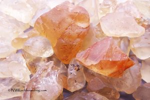
This site offers rewarding rockhounding opportunities, especially for red jasper, though other minerals may also be found. Most collecting spots are located along the well-maintained forest road and are accessible by most vehicles from late spring through mid-fall.
Dry Creek Rockhounding
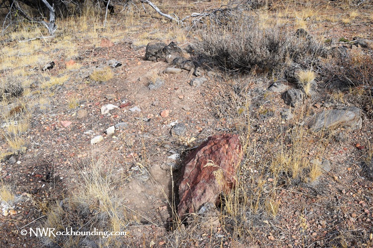
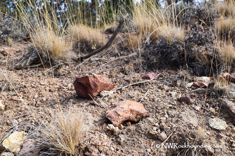
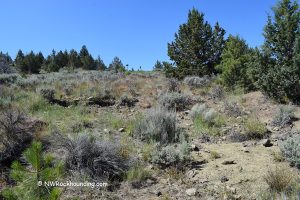
Once you get into the site, it is not hard to find the collecting spots. After dark basalt slopes, you will see loose volcanic soil with reddish jasper and silicified volcanic fragments in the gravel.
Exploring the site involves searching on hillside slopes, where erosion exposes material. Park safely and examine the hills. A geology pick and shovel can help uncover partially buried specimens.
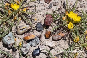
The area contains red jasper, common opal, agate, and quartz. Jasper is light red though we found a few dark red specimens.
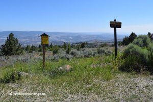
Two notable collecting sites are listed in this area, but there are more to explore. For those who would like to venture farther, check other locations along the road.
Things to Do near Dry Creek: Beyond the Rocks
Dry Creek is close to other excellent collecting areas, which can make for a nice addition to a multi-day trip to Southeastern Oregon. Crane Creek Thunderegg Bed is located 30 miles northeast.
Another popular destination in Lake County is the Sunstone Public Collection Area, located 65 miles northeast of Lakeview, where visitors can dig for sunstones.
Lakeview and the nearby areas have plenty of fun things to do. Known as the 'tallest' town in Oregon, Lakeview sits at an elevation of 4,800 feet. Visitors can enjoy a relaxing soak in the hot mineral pools at Hunter Hot Springs Resort, and watch 'Old Perpetual Geyser,' which shoots water into the air several times a day.
About 15 miles from town, the Hart Mountain National Antelope Refuge is home to the Pronghorn Antelope, the fastest land animal in North America. Visitors can camp, look for rocks, hike, soak in the Antelope Hot Springs, and watch the area's wildlife.
Dry Creek | Facts
Material: Jasper, agate, quartz, common opal
Tools: Geological pick, shovel
Land type: Forested hill
Best time to visit: From May to October
Land manager: U.S. Forest Service
Fees: None
Location: 24 miles southwest of Lakeview • Oregon • USA
Road access: Any vehicle during dry season
Elevation: 5,600 ft (1,700 m)
Places to Stay near Dry Creek Area
Dispersed (primitive) camping is allowed almost anywhere on national forest land unless posted otherwise (such as near developed campgrounds, trailheads, or sensitive areas).
For visitors who prefer a more structured camping environment, the Goose Lake State Recreation Area, located 15 miles south of Lakeview, offers a range of amenities. Open from April to October, the campgrounds operate on a first-come, first-served basis and provide tent sites, electrical hookups, flush toilets, and hot showers.
Alternatively, about 12 miles north, the Drews Creek Campground offers seasonal tent camping. It's a quiet scenic place surrounded with, with chances to hike, fish, and watch wildlife.
If you’d rather stay indoors, Lakeview has plenty of affordable hotels, motels, and vacation rentals for travelers looking for a cozy place to rest.
Lodging is available in Lakeview
Affordable vacation rentals for short and long term stay at Lakeview
You May Also Like


Directions to Dry Creek
From Lakeview,
- Take Highway OR-140 and drive 7.3 miles west to Tunnel Hill Road
- Turn left onto Tunnel Hill Road and follow it for about 3 miles
- Continue straight for 4.8 miles as the road becomes County Highway 1-11
- Turn right onto Horseshoe Meadow Road (County Highway 1-11) and continue for 2 miles
- The road transitions into Forest Road NF-4020 - follow it for 5.8 miles to Site 1
- Continue 1.2 miles to Site 2.
GPS (Site 1): N 42°03.140' W 120°36.546' | 42.0523, -120.6091
Comments are closed, but trackbacks and pingbacks are open.