
Located just off the I-5 corridor in Southern Oregon, the town of Myrtle Creek offers easy access points to the South Umpqua River.
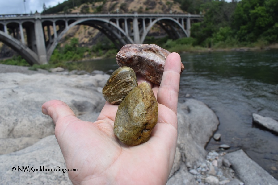
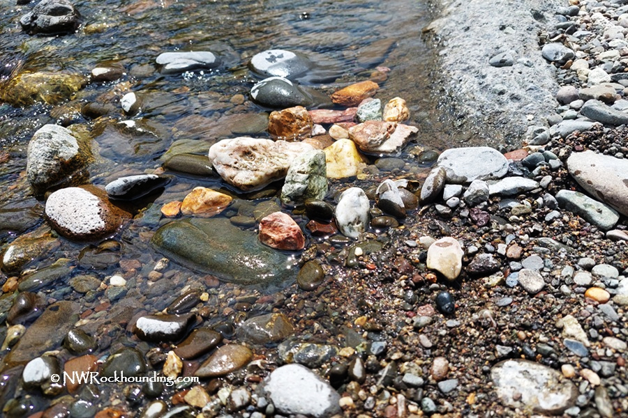
The river here features extensive gravel bars, loaded with collectible material, including agates, jasper, quartz, and petrified wood.
The first site north of town, near Exit 108, provides quick and convenient access, while a second site about a mile south, along the river bend, has longer gravel bars and an even wider variety of rocks.
Myrtle Creek Rockhounding
The South Fork of the Umpqua River at Myrtle Creek features large gravel bars with a variety of rock types.
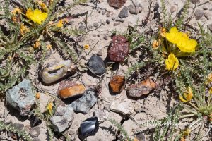
Shiny, sugary quartz and clear or milky chalcedony are most common. Jasper is abundant in many colors, from deep red to brown and green, and some pieces have interesting patterns.
Agates are rarer, but it is still possible to find some with reddish or clear layers and small crystal centers that look like tiny geodes.
Pieces of petrified wood appear from time to time, usually in brown or gray tones. Other "weird" rocks are often polished into attractive stones here.
Recreational gold prospecting is popular in the area, too. Fine flour gold has been found in pockets along the river, and parts of the riverbed have been dredged in the past.
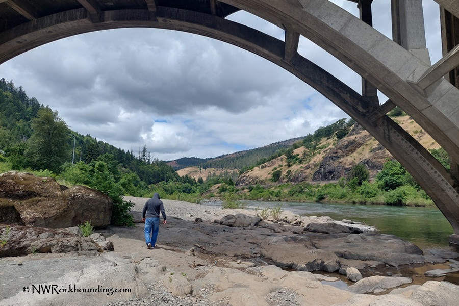
Highway Bridge (N Main Street): Pullout is located just off I-5, before the bridge, entering town from Interstate 5. A 0.1-mile trail, right of the pullout, leads down to the riverbank.
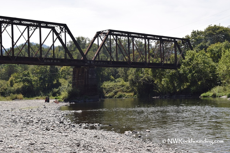
Railroad Bridge (Western Avenue): Located approximately one mile south, this riverbank features extensive gravel bars and is also popular in summer for swimming and kayaking.
Best time to collect: Rockhounding is possible year-round, but late summer through early fall is best. Water levels are lower by August and September, revealing the largest gravel bars and making it easier to walk along the river.
🟡 By late summer, algae or cyanobacteria can grow on rocks. These can be harmful to humans and pets, so watch for posted warnings and always wash your hands and any collected rocks thoroughly.
Upper South Umpqua Rockhounding
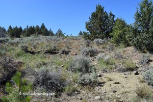
Myrtle Creek is a part of a 30-mile stretch of productive rockhounding section of the South Umpqua River. The upper part of the river has even more extensive gravel bars to collect cool rocks at.
Oregon Route 227 follows along the river from Canyonville through Days Creek and Tiller and passes multiple collecting sites you can explore.
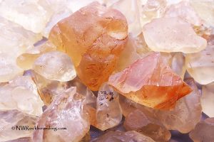
Some rocks you can find are sugary quartz, clear agate, jasper, carnelian, and petrified wood. Some rockhounds found agate geodes up to 5 inches long. Also, the highly prized and rare deep red carnelian that makes the South Umpqua famous among rock hunters is more common in certain tributary creeks.
South Umpqua River Rockhounding – Explore 30 Miles of Gravel Bars
Things to Do at Myrtle Creek: Beyond the Rocks
In addition to the river, Myrtle Creek is a cozy small town with basic services, local cafes, and quiet streets.
Several historic covered bridges are located nearby, including Neal Lane, Horse Creek, and Milo Academy Bridges.
Canyonville is a short drive south and offers additional dining options, nearby walking areas, and access to Interstate 5.
The area provides good access to outdoor recreation, including hiking, camping, boating, fishing, and swimming along the South Umpqua River and Cow Creek.
The South Umpqua River has many swimming areas popular during the warm summer months, including shallow wading spots and deeper pools.. There are both shallow wading areas and deeper swimming spots.
Water stays cooler in early summer due to forest shade and mountain origins. By late August, temperatures reach about 70°F at South Umpqua Falls.
The best swimming conditions are from July through September, when river flows are lower and weather is warmer.
South Umpqua River - Visit Hidden Swimming Holes Along the River
Myrtle Creek Rockhounding | Facts
Material: Quartz, chalcedony, agate, jasper, petrified wood
Tools: Sand Dipper Square Scoop
Land type: Riverbank
Best time to visit: Year-round
Land manager: Bureau of Land Management (BLM)
Fees: None
Location: Myrtle Creek • Oregon • USA
Road access: Any vehicle
Myrtle Creek Camping and Lodging
There are several primitive campgrounds, managed by the Forest Service, along the upper South Umpqua River. They are operated on the first-come, first-served basis, offering basic amenities.
Dumont Creek Campground is a small, quiet spot right on the river.
Boulder Creek Campground is another calm riverside site with easy access to nearby collecting areas.
Ash Flat Campground, about three miles east of Boulder Creek, provides an additional option for visitors exploring the upper river.
For more comfortable accommodations, book your stay in Myrtle Creek or Canyonville, 10 miles south.
You May Also Like


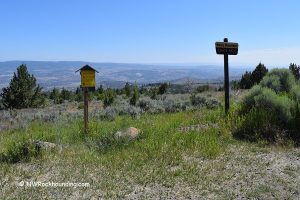
South Umpqua River Access Points at Myrtle Creek
From Interstate 5 to Site 1 at Bridge Parking Area,
- Take Exit 108 at Myrtle Creek and then turn east toward Main Street.
The parking area will be on your right just before the bridge crossing the South Umpqua River.
Bridge Parking (Site 1): N 43°01.509' W 123°17.834' | 43.0252, -123.2972
For Site 2 at Western Avenue,
- Cross the bridge and follow Main Street for 1 mile to Western Avenue
- Turn right onto Western Avenue and then continue for 0.3 miles.
Western Avenue (Site 2): N 43°01.079' W 123°18.015' | 43.0183, -123.3002