
The Selway River flows through north-central Idaho, winding from rugged mountains near the Montana border into deep forests and valleys.
Along its course, it cuts through the granite of the Idaho Batholith and surrounding metamorphic rocks, creating scenic gravel bars and river-smoothed stones. Near Lowell, the Selway River meets the Lochsa River, and together they form the Clearwater River, a major tributary of the Snake River system.
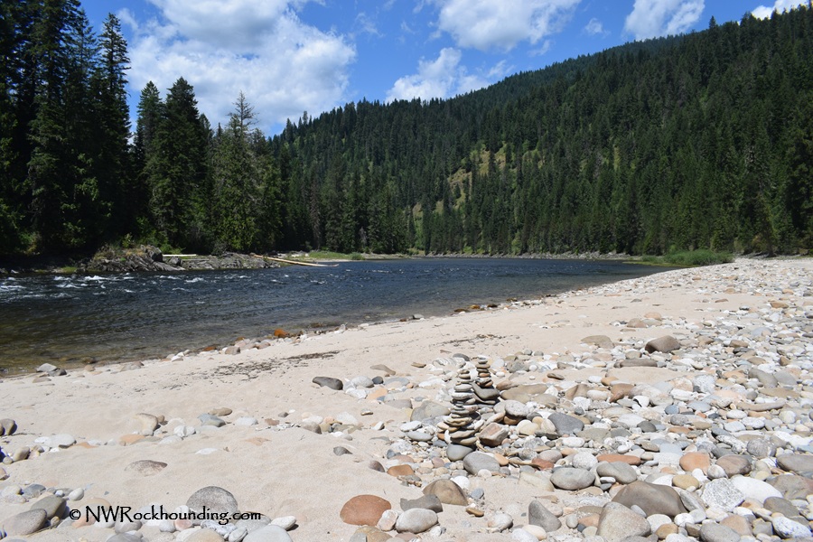
Several locations along the Selway River offer good gravel bars and easy access to the water. One of these is Johnson Bar, located about 4 miles south of U.S. Highway 12. A Forest Service campground nearby makes it a convenient place to stop or stay overnight. When river levels are low, wide gravel bars and exposed riverbanks provide clear views of river-worn rocks and other natural materials.
Most of the Selway River corridor is managed by the U.S. Forest Service, and the upper sections lie within the Selway-Bitterroot Wilderness, a protected area that preserves the river’s remote, natural character.
Rockhounding along the Selway River
When river levels are low at Johnson Bar, extended gravel bars and exposed streambeds allow plenty of space to spend time rock hunting.
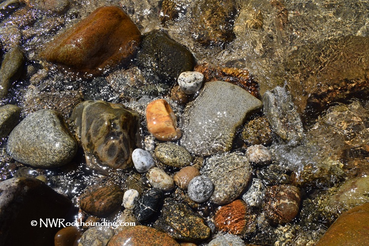
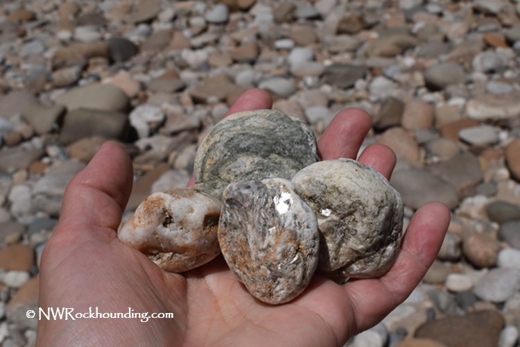
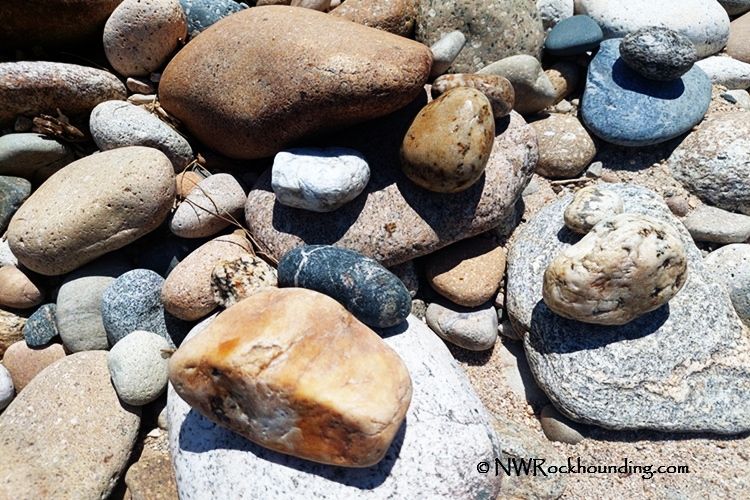
You’ll encounter a wide mix of material here, including quartz, jasper, petrified wood, schist, gneiss, and plenty of granite pebbles, with occasional pieces of basalt or compacted volcanic ash. Mica shows up as bright, glittering flakes when the sun hits it just right, and you might even find a bit of sillimanite, but it is quite uncommon.
Most collecting is simply a matter of walking the bars and picking by hand, though a geology hammer or pick is handy for prying loose stubborn pieces or checking rocks that are partly embedded.
A gold pan can also be useful for washing a sample of black sands from natural “trap” spots (behind boulders or fallen logs) where the heavier minerals tend to collect. Whatever methods you use, be sure to backfill any holes and leave the riverbank looking as undisturbed as possible.
Exploring Selway River Area: Beyond the Rocks
The Selway River region offers many other outdoor adventures in addition to rockhounding. The river offers challenging whitewater for experienced rafters, but it also has calmer stretches for scenic floats. Fishing is excellent, with native trout populating the clear waters.
The surrounding forests are home to elk, deer, black bears, and other wildlife. Miles of trails wind through the wilderness for hiking and backpacking, providing solitude and scenic views.
Backcountry hot springs in the area are a fantastic, relaxing stop after hiking and exploring.
Weir Creek Hot Springs and Jerry Johnson Hot Springs are scenic wild destinations, while the Lodge at Lolo Hot Springs is a rustic but well-developed hotel with private soaking for overnight guests only.
Selway River Rockhounding | Facts
Material: Quartz, jasper, petrified wood, schist, gneiss, granite, basalt, compressed volcanic ash, rare sillimanite
Tools: Rock hammer, geology pick, gold pan, hand lens, gloves, safety glasses
Land type: Riverbanks
Best time to visit: Late summer (low water exposes large gravel bars)
Land manager: USDA Forest Service – Clearwater National Forest
Fees: None
Location: 30 miles east of Kooskia • Idaho • USA
Road access: Any vehicle in dry conditions
Places to Stay near the Selway River
Johnson Bar Campground is the closest Forest Service campsite with RV and trailer pads, 7 individual campsites (including a reservable group camping spot), picnic areas, toilet facilities, drinking water, and a swimming beach. Some areas, including the picnic area, are wheelchair accessible.
For more comfortable lodging, go west of Johnson Bar to Kooskia, 30 miles away, or Grangeville, 50 miles away.
Lodging in Kooskia or Grangeville
You May Also Like


Selway River Directions
From Kooskia,
- From downtown Kooskia, head toward Main St and turn left onto Main Street
- Continue on Main St for 0.3 miles, then turn right onto Broadway Ave
- Follow Broadway Ave for 0.4 miles as it becomes ID‑13/ID‑13 BUS E/Business 12
- Turn right onto US‑12 E and drive approximately 21.6 miles toward Lowell
- Just before Lowell, turn right onto Selway Road
- Continue on Selway Rd for about 4.1 miles along the Selway River
- Turn right onto Forest Rd 223N (Forest Rd 223N1) and follow it for 0.2 miles
- Watch for the Johnson Bar Campground and river access area on the left.
GPS (Johnson Bar): N 46°06.224' W 115°33.633' | 46.1039, -115.5605
GPS (Selway Falls): N 46°03.155' W 115°18.333' | 46.0525, -115.3055