The Willamette River flows north through the wide and fertile Willamette Valley before joining the Columbia River near Portland. Along its course, it is fed by several major tributaries, including the McKenzie, Santiam, Clackamas, and Yamhill Rivers. These rivers drain different mountain regions and contribute a wide variety of rocks.
The Willamette River is known for its variety of collectible stones, as its gravels are composed of materials transported from different regions.
Common finds include basalt, andesite, quartz, jasper, agate, and occasional petrified wood - typically rounded and smoothed by long transport in the river.
Interestingly, minerals from regions such as eastern Washington, Idaho, and even British Columbia can also be found in the Willamette. The region’s geological history explains this fact.

Willamette River Geological History
During the Ice Age, a series of massive floods known as the Missoula Floods swept across the region. These floods originated from Glacial Lake Missoula and rushed down the Columbia River.
When the floodwaters reached the narrow Columbia River Gorge, they backed up into the Willamette Valley, forming a temporary lake known as Glacial Lake Allison. At that time, most of the valley was underwater—only the highest hills remained above the surface.
These floods occurred repeatedly between about 15,000 and 13,000 years ago. Each event carried enormous amounts of gravel, sand, and rock from distant regions. As the floodwaters slowed in the valley, they deposited thick layers of sediment that still shape the landscape today.

Why This Matters Today
Because of this history, the Willamette River acts as a natural mixing zone. Rocks from many different regions were deposited here and continue to be reworked by the river.
Seasonal flooding continues to reshape gravel bars and can expose new material.
Flood deposits are especially evident in:
• Around Salem and Albany (fine silts and clays)
• Near Portland and the lower valley (gravels and glacial erratics)
• Along river corridors where older gravels are exposed.

Rockhounding along the Willamette River
The Willamette River’s gravel bars represent a mix of three geological sources:
• Volcanic rocks from the Cascades
• Sedimentary rocks from the Coast Range
• Ice Age flood deposits from Idaho and Washington.
The river contains a variety of collectible stones, including agate (carnelian, moss, and dendritic), jasper (red, yellow, and brown varieties), quartz (milky and clear), chert, and petrified wood.
However, there are no clearly designated, fully legal rockhounding sites along the main river.

The river passes through a mix of ownership, including private property, city parks, county land, and state-managed areas where collecting may be restricted or prohibited.
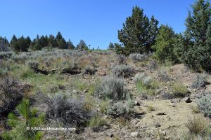
To find suitable places, focus on open gravel bars outside of developed parks and without posted restrictions.
Near Eugene and Corvallis, look for less-developed river access points rather than city parks.
Around Salem, wider gravel bars along quieter stretches of the river can offer better opportunities.
In the Portland area, access is more limited, so extra care is needed to avoid restricted zones.
Using mapping tools such as land ownership maps or apps can help identify BLM land and public access areas.
You May Also Like