
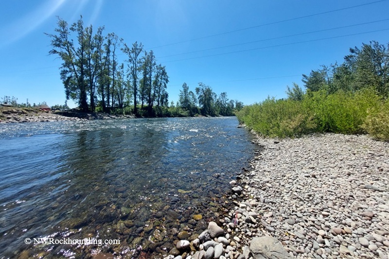
Stayton Bridge in western Oregon crosses the North Santiam River, just a short drive east of Salem. This stretch of river lies where the Cascade foothills begin to flatten into the Willamette Valley, at an elevation of about 400 feet.
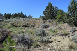
The bridge area offers easy rockhounding access along broad gravel bars, shallow riffles, and open riverbanks on public land.
The North Santiam River begins near Mount Jefferson and carries volcanic rock from the Cascades roughly 40 miles downstream before reaching Stayton.
Along the way, the fast-moving river tumbles, smooths, and polishes the stones it carries. By the time the rocks reach this area, many are rounded, colorful, and easy to sort through along the gravel bars.
Stayton Bridge Rockhounding
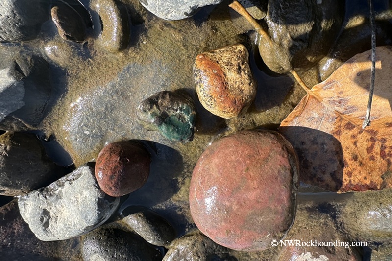
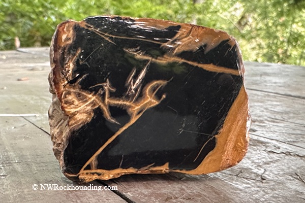
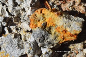
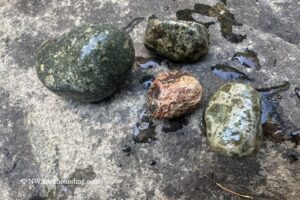
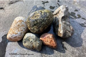
The area is known for agate, jasper, petrified wood, quartz, and basalt.
Agate here is usually clear and pale yellow tones, sometimes with soft banding. Most pieces are small, around 1 to 3 inches, and partly translucent when wet.
Jasper is the most common find. It's opaque and shows up in red, brown, yellow, and sometimes a subtle green. You'll often spot it sitting right on top of the gravel.
Petrified wood appears in muted earth tones such as black, brown, and dark red. Some pieces still show clear wood grain, which always feels like a small discovery.
Quartz appears as clear or milky pieces, usually smaller than the jasper.
The best time to visit is late spring through early fall, when the water drops, and the bars are wide open.
Stayton Bridge: Things to Do Nearby
Other upstream locations along the North Santiam River are also worth exploring for rockhounding and river access. Areas such as Fishermen's Bend Recreation Site and Breitenbush River near Detroit offer good bank access, gravel bars, and additional opportunities to search for smooth Cascade volcanic stones.
The North Santiam corridor has plenty going on beyond rockhounding.
Silver Falls State Park sits about 20 miles south and holds ten waterfalls along an 8-mile loop trail.
Detroit Lake, around 45 miles upstream, offers boating, swimming, and camping on a 3,500-acre reservoir.
Breitenbush Hot Springs and Lower Breitenbush Hot Springs provide a relaxing soak after a long day on the gravel bars.
The nearby Little North Santiam River is famous for its clear swimming holes and scenic canyon.
Salem, just 15 miles west, has all the food, fuel, and lodging you'd need.
Stayton Bridge | Facts
Material: Agate, jasper, petrified wood, quartz, basalt
Tools: Geology pick, sand dipper, or beach scoop
Land type: River gravel bars and forested banks
Best time to visit: Late spring through early fall
Land manager: Bureau of Land Management (BLM)
Fees: None
Location: Marion County • Oregon • USA
Road access: Any vehicle
Elevation: 400 ft (120 m)
Stayton Bridge Camping and Lodging
There's no developed campground right at Stayton Bridge, but plenty of options sit within 30 to 45 miles upstream.
Detroit Lake State Park is the largest, with 107 full-hookup sites, 68 electric/water sites, and 96 tent sites. It also offers boat ramps, a fishing dock, and swimming areas. Reservations are required.
Cove Creek Campground has 60 sites and fits trailers up to 30 feet.
South Shore Campground on Detroit Lake offers 25 single sites and 5 double tent sites.
Detroit Lake & Big Cliff Lake Recreation Area
For hotels, Salem is within driving distance and offers a wide range of accommodations.
You May Also Like


Directions to Stayton Bridge
From Interstate 5,
- Take exit 253 in Salem and head east on OR-22 (North Santiam Highway) toward Detroit Lake
- Drive 11.5 miles and take exit 13 toward Stayton/Sublimity, then turn right onto Cascade Highway
- Continue south on Cascade Highway for 1.6 miles to the parking area near the river.
GPS (Stayton Bridge): N 44°47.587' W 122°47.655' | 44.793, -122.794