
McBride Creek Road in southwestern Idaho runs along McBride Creek through a broad section of the Owyhee Plateau. This high desert region is known for its remote volcanic landscapes, rolling sagebrush hills, and deeply cut drainages.
This road corridor offers multiple rockhounding areas spread across the creek bed, dry washes, slopes, and cliff exposures on public BLM land.
Geology of the Area
The geology along McBride Creek Road is geologically diverse, shaped by Miocene volcanic activity (approximately 15-17 million years ago), followed by long periods of erosion and sedimentation.
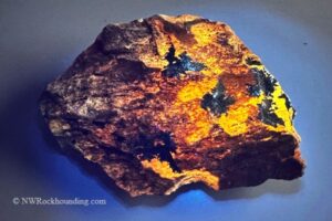
Over time, as volcanic rocks fractured and cooled, silica-rich groundwater moved through cracks and voids, forming quartz, agate, jasper, common opal, and occasionally petrified wood.
Erosion from seasonal water flow continues to break down the landscape today, exposing new material in creek beds and slopes and revealing fresh collectible specimens.
In lower-energy environments such as lakes, ponds, and floodplains, fine volcanic ash settled and formed light-colored tuffaceous siltstone and shale-like layers.
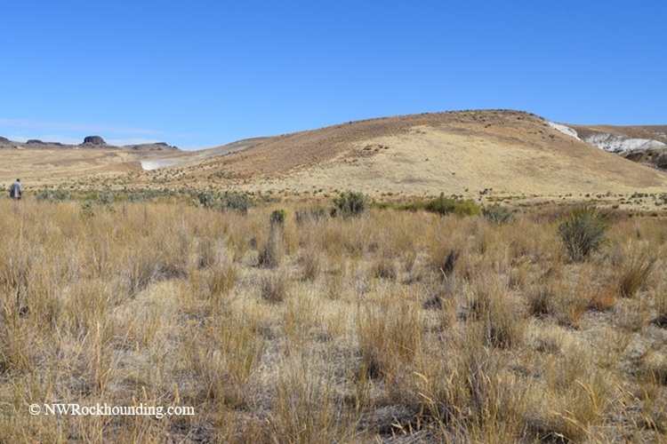
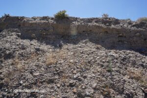
These pale sedimentary exposures can form striking white to light-gray hills, often highly eroded and soft, which are the primary fossil-bearing area.
McBride Creek Rockhounding
The area is known for opportunities to find quartz, agate, jasper, common opal, petrified wood, and plant fossils.
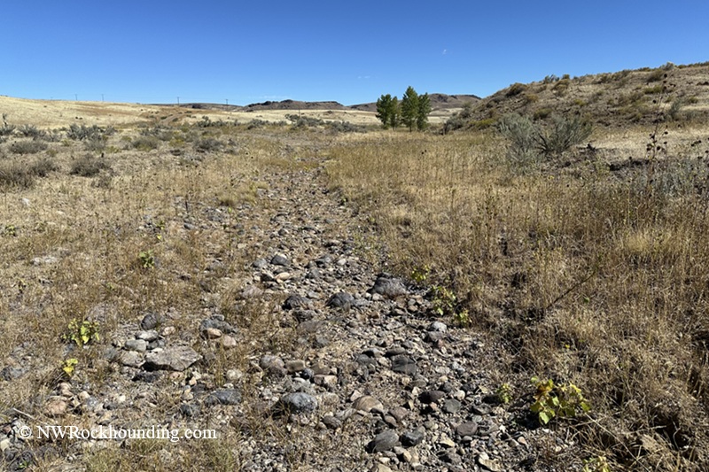
As you drive along McBride Creek Road and enter land managed by BLM, you can check any of the promising areas along the creek bed, gulches, dry washes, and hills.
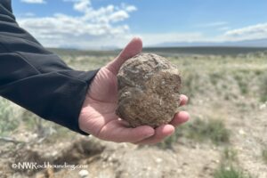
The McBride Creek area produces a typical mix of Owyhee-region silica materials.
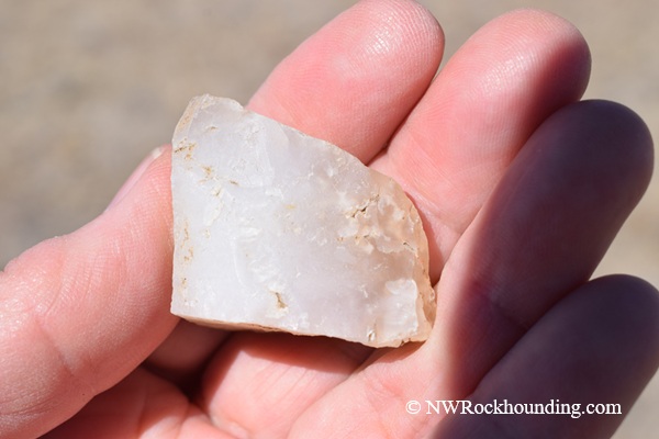
Agate is usually found as small to medium pieces that are partly translucent. Common colors include white, yellow, gray, and light blue.
Some pieces show banding, while others may have cloudy or moss-like patterns. Most agates are weathered on the outside, with better color visible when cut or broken.
Jasper is often more abundant and easier to spot. It is typically opaque and occurs in red, brown, and yellow shades.
Petrified wood can be found in certain parts of the area, especially where ancient plant material was buried. These pieces often appear in yellow, orange, tan, or brown tones and may preserve visible wood grain. In some cases, the wood is fully agatized.
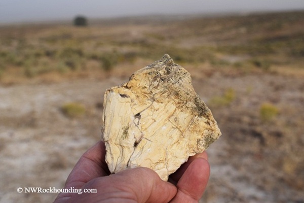
Common opal is most often found in white, cream, or pale yellow tones, and sometimes appears as coatings, small seams, or nodules within volcanic rock.
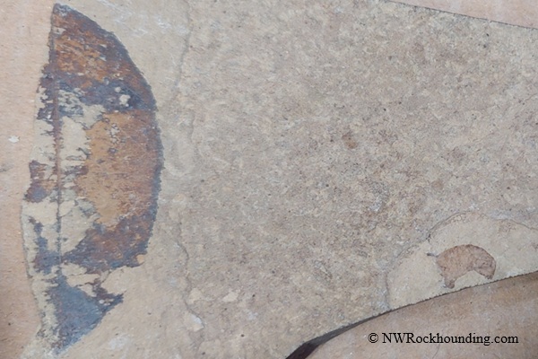
Plant Fossils
In some sections along McBride Creek Road, collectors observelight-colored, soft, cliff-forming sedimentary exposure.
The fossil mainly includes broadleaf trees similar to oak, maple, alder, and birch, along with shrubs that grew near rivers and floodplains.
Things to Do Nearby
The surrounding Owyhee region offers plenty to do.
The Owyhee Uplands Back Country Byway is a scenic drive worth a half-day on its own. Rockhounds often pair a McBride Creek trip with a stop at Succor Creek in Oregon, just across the border, which is famous for thundereggs and agate.
Marsing is the nearest town for fuel, food, and basic services.
The Snake River corridor is close by for fishing and picnics, and Givens Hot Springs offers an affordable soak in mineral water.
McBride Creek | Facts
Material: Agate, jasper, common opal, petrified wood, quartz, leaf fossils
Tools: Geology pick, chisels for fossils
Land type: Sagebrush high desert with creek bed
Best time to visit: Summer through early fall
Land manager: Bureau of Land Manager (BLM)
Fees: None
Location: Owyhee County • Idaho • USA
Road access: Any vehicle, 4WD suggested
Elevation: 3,869 ft to 4,285 ft (1,179 m to 1,306 m)
McBride Creek Camping and Lodging
There are no developed campgrounds at McBride Creek.
However, primitive dispersed camping is allowed throughout the surrounding BLM land.
For trailers and RVs, Snake Valley RV Park in Marsing is a popular headquarters.
Those wanting a real bed can find lodging in Homedale or Nampa.
Affordable vacation rentals for short and long-term stays at Homedale
You May Also Like


Directions to McBride Creek
From Marsing,
- Take US-95 south and travel about 19.1 miles
- Turn right (west) onto McBride Creek Road and travel about 0.7 miles to a unmarked track on the right
- Turn right onto the track and drive as long as it is safe for your vehicle.
The fossil site is located approximately 0.3 miles from McBride Creek Road. We stopped not far from the road and walked toward the big white hills, where leaf fossils, petrified wood, and agate can be found.
GPS(Fossil site): N 43°19.180' W 116°58.775' | 43.3197, -116.9796
For other sites, drive along McBride Creek and find promising locations along the creek bed, dry washes, and hillsides.