
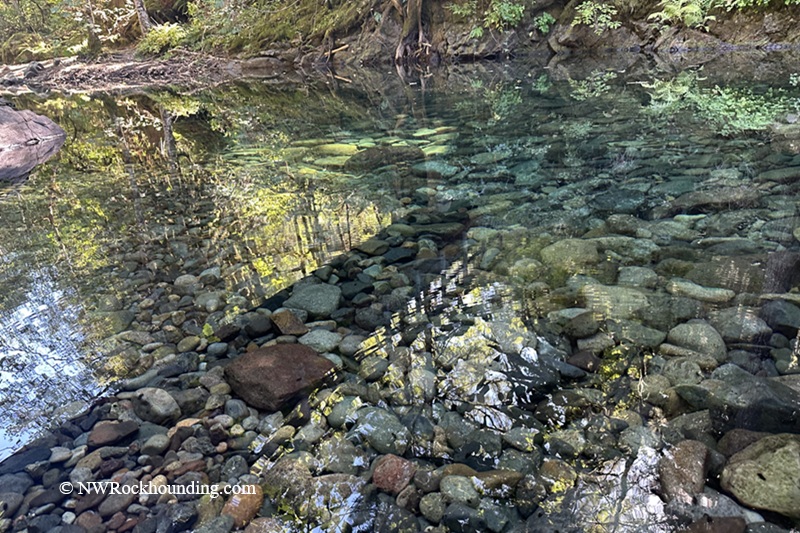
Brice Creek is a quiet mountain stream in the Umpqua National Forest. It begins high in the Cascade Mountains, Oregon. From there, the water flows down through forests and rocky slopes.
This area is also part of the old Bohemia Mining District, a place where miners once searched the hills for gold many years ago.
The creek is not heavily mined or changed. It still looks wild and natural. It is a good place for beginners and hobby collectors who like slow searching and quiet time in nature.
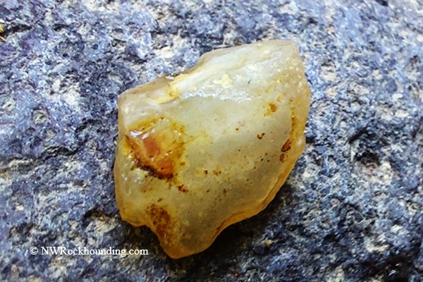
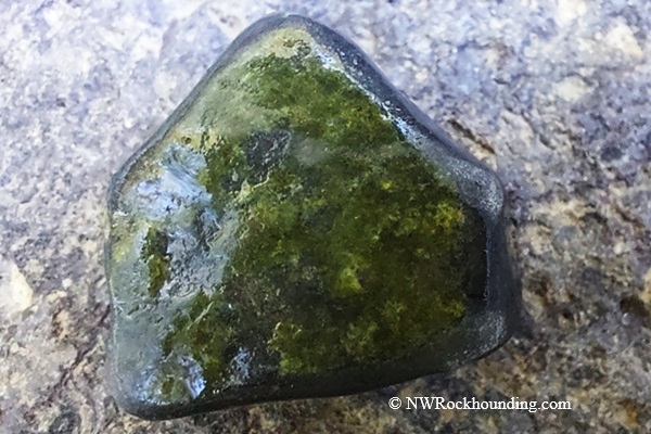
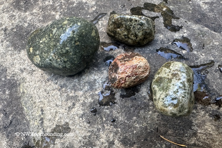
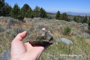
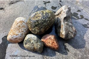
Gravel along Brice Creek commonly contains water-worn fragments of greenstone (altered basalt), porphyritic basalt, diorite, as well as occasional agate and iron-stained jasper.
Along gravel bars and in shallow water, you can also find dark mineral sands, where fine specks of gold may settle among the heavier sediments between the rocks.
Geology of Brice Creek
Brice Creek flows through the western slopes of the Cascade Mountains, an area shaped by volcanic activity during the Tertiary period.
Ancient eruptions deposited layers of andesite, breccia, and rhyolite, forming the foundation of the rugged landscape.
Hydrothermal activity associated with the Bohemia Mining District introduced mineralized quartz veins with trace amounts of gold and sulfide minerals into fractured volcanic rocks.
Over millions of years, erosion broke down these veins and transported material into the modern creek system.
This process created the conditions for present-day placer deposits, where fine gold and quartz fragments can still be found within stream gravels.
Brice Creek Prospecting
Brice Creek offers recreational opportunities for both gold panning and rockhounding.
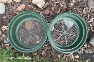
Gold panning: The creek contains black sands with fine placer gold and occasional small flakes. The heavier materials tend to settle in slow areas such as behind rocks, in natural crevices, along gravel bars, and on exposed bedrock during low water. Simple tools like a gold pan and small hand tools are usually enough for sampling.
Rockhounding: The creek gravels may produce water-worn greenstone (altered basalt), porphyritic basalt, diorite, and occasional agate and iron-stained jasper. Agate and jasper are less common and are best found after seasonal water flows expose fresh gravel.
Once on U.S. Forest Service land, which is primarily used for recreation, look for access points to the creek. Focus on exposed gravel bars for rockhounding, and stream bends and exposed bedrock areas, where heavy materials like gold tend to concentrate.
Brice Creek - Things to Do
Besides recreational prospecting, the creek and its surroundings are used for outdoor activities including camping, hiking, and swimming.
The creek is accessible via Brice Creek Trail, as well as numerous campgrounds and day-use areas along the canyon.
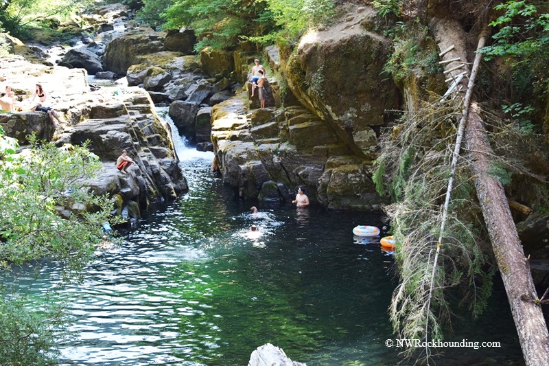
One of the main highlights is Brice Creek Falls, a popular and easy-to-reach destination with a swimming hole at the base of the waterfall.
Blue Hole Falls, in contrast, is hidden and harder to find, offering a secluded, off-the-beaten-path experience for those who seek it out.
The area is especially popular in summer for swimming in clear pools and camping in the forested scenery.
Quartzville Creek Rockhounding | Facts
Material: Fine gold, flakes, altered and porphyritic basalt, agate, jasper
Tools: Gold pan, sluice, Sand Dipper Square Scoop
Land type: Stream bank
Best time to visit: Late summer through early fall
Land manager: U.S. Forest Service
Fees: None
Location: Lane County • Oregon • USA
Road access: Any vehicle
Brice Creek Camping and Lodging
Camping along Brice Creek is a popular way to enjoy the forested canyon and spend time by the water.
Several campgrounds, including Lund Park Campground, Cedar Creek Campground, and Hobo Campground, offer basic facilities in a natural setting.
These sites provide access to hiking trails along Brice Creek, swimming holes, and quiet spots by the water.
If you prefer more comfortable accommodations, consider staying in Cottage Grove.
Affordable vacation rentals for short- and long-term stays in Cottage Groove
You May Also Like


Brice Creek Public Access Sites
From I-5 at Cottage Grove,
- Take Exit 174 toward Dorena Lake and travel east on Row River Road; the road becomes Shoreview Drive and continue for about 18.5 miles to the junction of Layng Creek Road (#17) and Brice Creek Road (#2470/22)
- Turn right onto Brice Creek Road and continue for 3.3 miles to West Brice Creek Trailhead.
From here, you can hike along the creek or continue driving on Brice Creek Road to reach additional trailheads and campgrounds.
GPS (West Brice Creek Trailhead): N 43°40.482' W 122°43.803' | 43.6747, -122.7301
GPS (Cedar Creek Campground): N 43°40.260' W 122°42.477' | 43.671, -122.708
GPS (Lund Park Campground): N 43°39.044' W 122°40.741' | 43.6507, -122.679