
Located about 13 miles north of Soda Springs, China Hat is a small extinct volcanic cone in Caribou County, Idaho, known for its unusually fluorescent rhyolite.
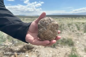
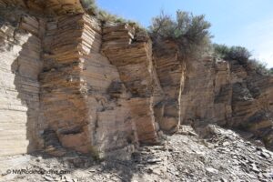
This ancient volcanic site exposes glassy, frothy rhyolite in road cuts along the north side of the cone. Under long-wave ultraviolet light, the rock glows in striking cream-to-orange tones, making it a sought-after find for fluorescent mineral collectors.
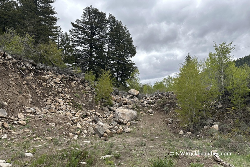
The main collecting area lies along a public county road. You can pick up loose rocks from the ditch and road cuts. A nearby old quarry is on private land. Access has historically been allowed by local custom, but conditions may change.
The surrounding landscape is mostly open farmland with low hills and distant mountains.
China Hat formed millions of years ago during strong volcanic activity.
This area is part of the larger Yellowstone Plateau volcanic region, which has shaped the land through many eruptions, lava flows, and geothermal activity.
The cone likely formed when thick, silica-rich magma rose from deep underground. Unlike runny lava, this thicker magma did not flow far. Instead, it built up near the opening, forming a steep hill.
Another two nearby volcanic features, China Cap and North Cone, stand just to the north, forming a small cluster of extinct volcanoes.
China Hat Rockhounding
The best collecting takes place along the road cuts on the north side of the cone.
The light-colored outcrops are easy to spot, and loose rhyolite can often be collected directly from the ground and exposed surfaces.
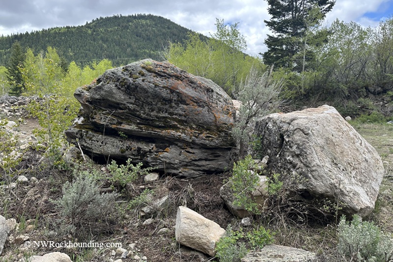
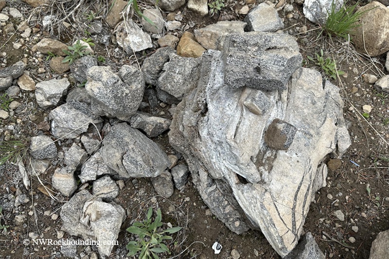
The material is typically light gray, glassy rhyolite with a vesicular, pumice-like texture.
Many pieces are lightweight and filled with tiny gas bubbles formed during eruption.
In daylight, the rock appears fairly ordinary—pale gray, rough, and unassuming. Under UV light, the rhyolite can glow in shades of soft cream to bright orange. Some pieces glow evenly across the surface, while others show streaks, patches, or mottled patterns.
Bringing UV light is essential in the field, or the best specimens may be overlooked.
Best time to collect: Spring through fall. The site sits at roughly 6,100 to 6,170 feet elevation, so mornings run cool even in midsummer.
LUMENSHOOTER S3 365nm UV Flashlight with 3 LEDs
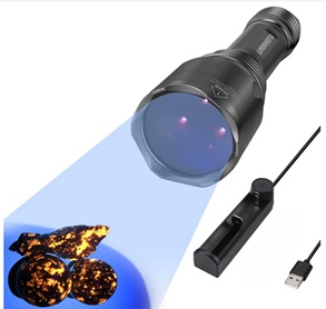
- Why I Like It: This light is affordable, easy to use, rechargeable, and powerful.
- It's small enough to carry in your pocket and perfect for beginners.
- Best For: General rockhounding tools for use in the field or at home.
![]()
![]()
If you make a purchase via our links, Northwest Rockhounding earns a commission at no additional cost to you
Things to Do Near China Hat
Blackfoot Reservoir lies just north of China Hat and offers fishing, boating, and scenic views across a wide-open valley. A small resort nearby provides basic amenities.
The Pioneer Historic Byway follows early settler routes through rolling hills and open rangeland, offering a quiet and scenic drive through Idaho history.
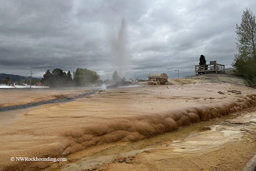
Just about 13 miles south, the town of Soda Springs is home to one of the region’s most famous natural features, the Soda Springs Geyser. This geyser is unique because it is the only known captive geyser in the world. It was accidentally released while drilling for hot water in 1937. Today, it erupts on a timed schedule, sending a tall column of carbonated water into the air and making it an easy and interesting stop for visitors.
About 60 miles southeast, Bear Lake is often called the “Caribbean of the Rockies” for its vivid turquoise water. The lake is popular for swimming, kayaking, fishing, and hot springs soaking.
For a relaxing soak after a day of collecting, consider Maple Grove Hot Springs near the Bear Lake area, about 60 miles south.
China Hat Rockhounding | Facts
Material: Rhyolite
Tools: Rock hammer, chisels, safety glasses, gloves, portable UV light
Land type: Road cut through volcanic cone; county road right-of-way and adjoining private land
Best time to visit: Spring through fall
Land manager: County road right-of-way (road cut); private land (old quarry, check access)
Fees: None
Location: Caribou County • Idaho • USA
Road access: Any vehicle
China Hat Camping and Lodging
Developed camping is available near Wayan, a small community northeast of the site along ID 34 with basic amenities.
Dispersed camping on Caribou-Targhee National Forest land is available to the east.
The resort near Blackfoot Reservoir provides more comfortable accommodations.
For motels and restaurants, Soda Springs is about 13 miles south and Montpelier is roughly 45 miles southeast.
For hot springs soaking after a day of collecting, consider Maple Grove Hot Springs near the Bear Lake area, about 60 miles south.
You May Also Like


China Hat Access and Directions
From Soda Springs,
- Drive north on Main Street to ID 34 East/Hooper Avenue and continue for 11.5 miles.
- Turn left onto China Cap Road and drive 1.5 miles
- Turn right onto Dike Road, follow it for 0.5 mile, and turn into the gated entrance.
This is private land, but the access has been allowed by custom, but check conditions before entering.